A portable ground survey system that fuses Transient Electromagnetics and Ground-Penetrating Radar into high-fidelity 3D subsurface digital twins — so you can locate lithium, cobalt and nickel and prioritise drill targets with confidence.

Drilling is the single largest cost in early exploration, and most holes miss. Conventional tools struggle with noise and depth resolution, so teams drill on thin evidence — burning budget on dry holes while commodity prices swing.
Every blind hole is capital spent with no return. Poor targeting multiplies the cost of every find.
Standard sensors miss deep, subtle mineral signatures — leaving targets undetected.
Raw geophysical data still needs specialist interpretation before a drill plan can be made.
Transient Electromagnetics resolves conductivity with depth; Ground-Penetrating Radar maps high-resolution near-surface structure. We fuse both and deliver a finished, interpreted 3D model — not raw data.
Roll the cart across the target area to acquire co-located TEM and GPR data.
Our algorithms turn raw signals into subsurface conductivity and structure.
Receive a 3D subsurface model that fuses depth and near-surface detail.
Prioritised, ranked targets your team can act on immediately.
Watch the survey software render subsurface data live as the cart moves — the exact on-screen view your team gets in the field.
Real-time acquisition GUI
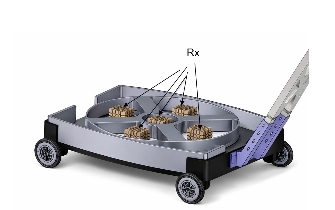
A high-current transmitter with a sharp 15 µs shut-off drives a large plastic-framed transmit loop, while an isolated five-coil receiver array captures the early-time decay that reveals deep mineral signatures standard sensors miss. Proprietary inversion turns it into a map.
Our physics maps the deposits that matter most to the energy transition.
Magmatic sulphide deposits are strongly conductive — classic, high-priority TEM targets detected against resistive host rock.
Brine-hosted lithium forms conductive saline aquifers TEM maps exceptionally well; hard-rock pegmatites are resolved with GPR structure.
Strategic resource mapping, plus adjacent uses — groundwater, regolith thickness, and void/utility detection.
No hardware to buy or specialists to hire. We mobilise the cart and a trained crew, run the survey, and deliver interpreted digital-twin models and ranked drill targets.
Our team deploys to your site and acquires co-located TEM + GPR data across the target area.
Our proprietary inversion and mapping produces a validated 3D subsurface digital twin.
You receive ranked drill targets and models — lowering cost per discovery.
Built on validated field deployments in utility and subsurface mapping — now focused on critical minerals.
Book a demo surveyTell us your site and target commodity — we'll come back with a survey plan.